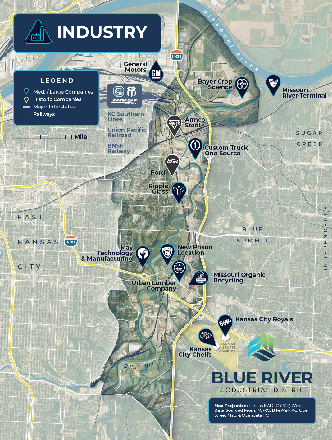
Digital Mapping
The possibilities are endless! I always am trying to push myself and explore new visual styles digitally. Everything from city zoning maps to skin tracks high in the alpine. If you have a map idea, bring it on.
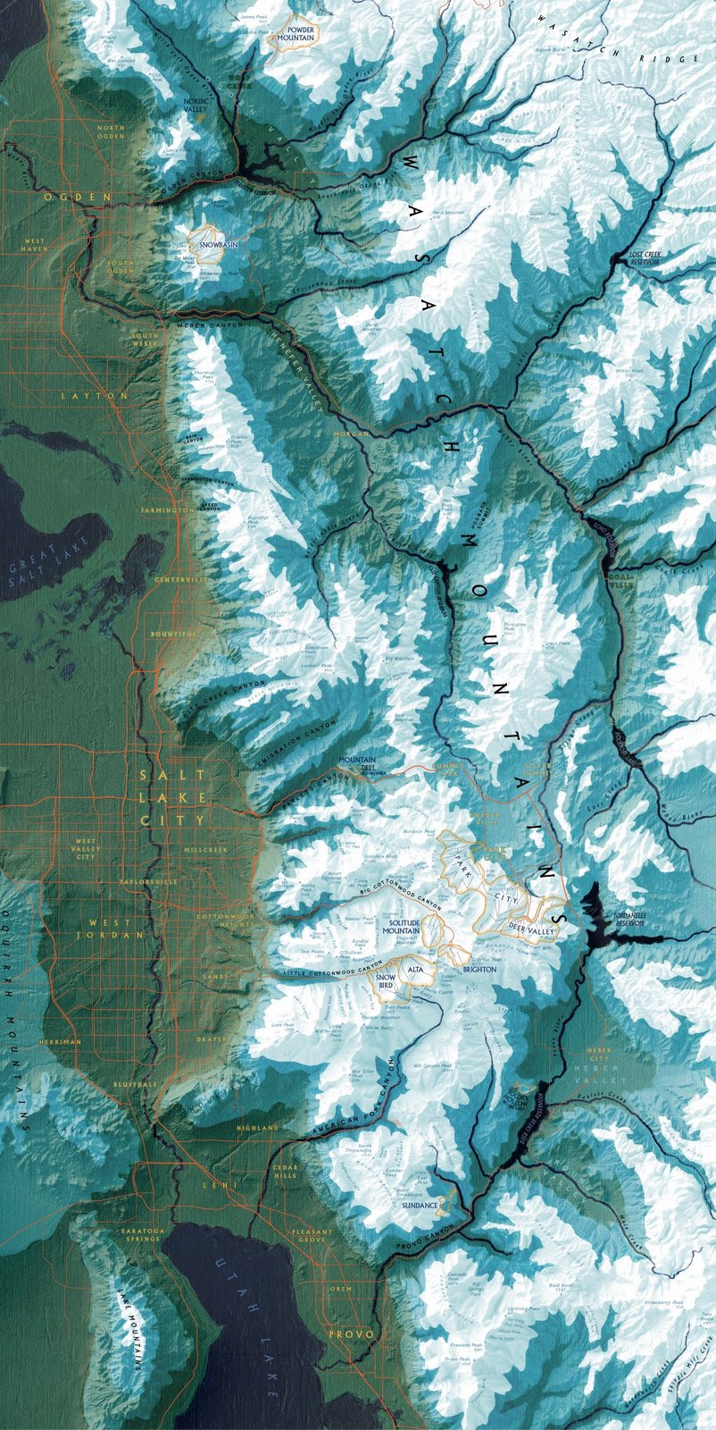
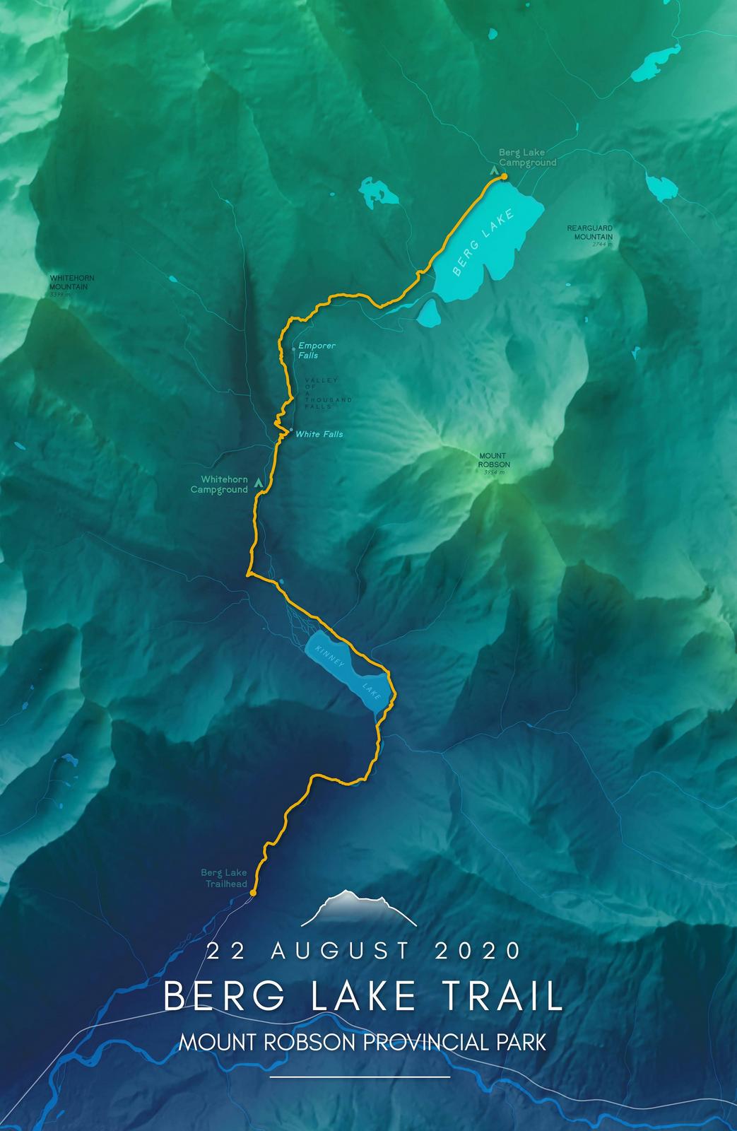
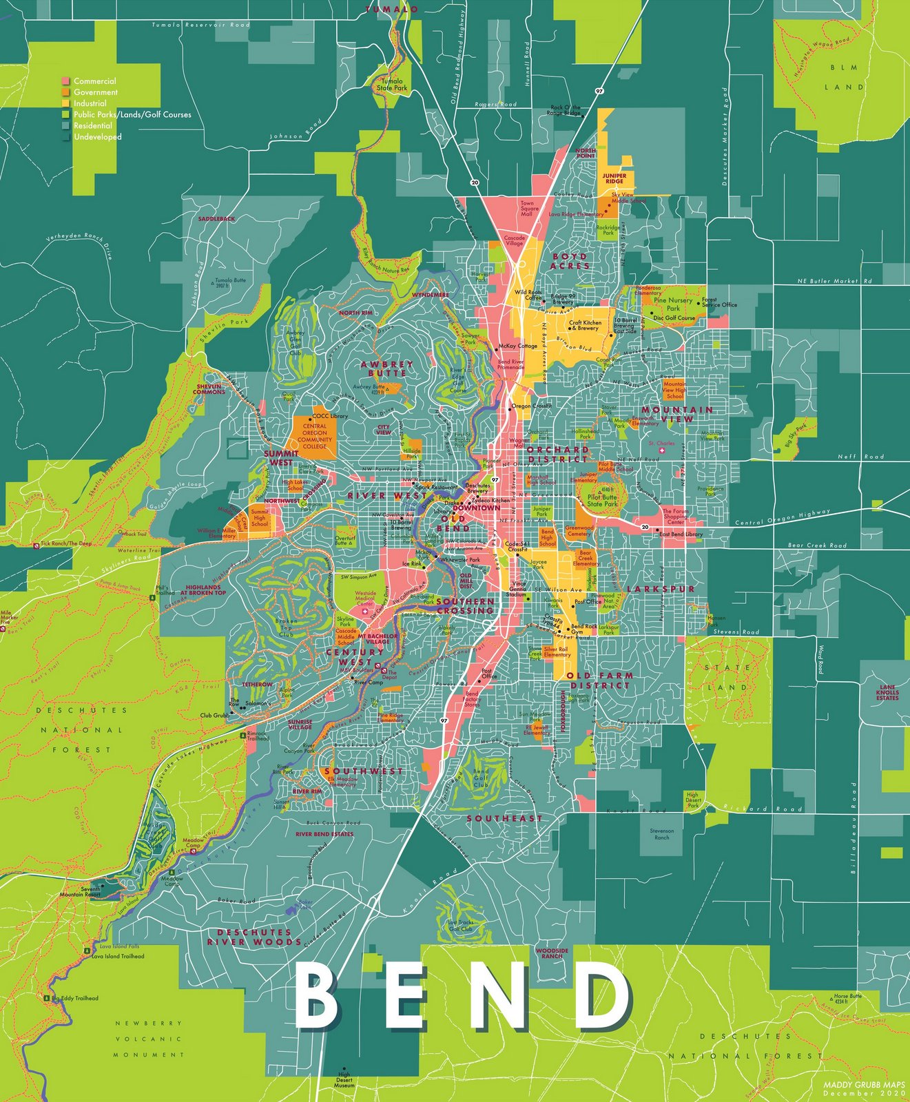
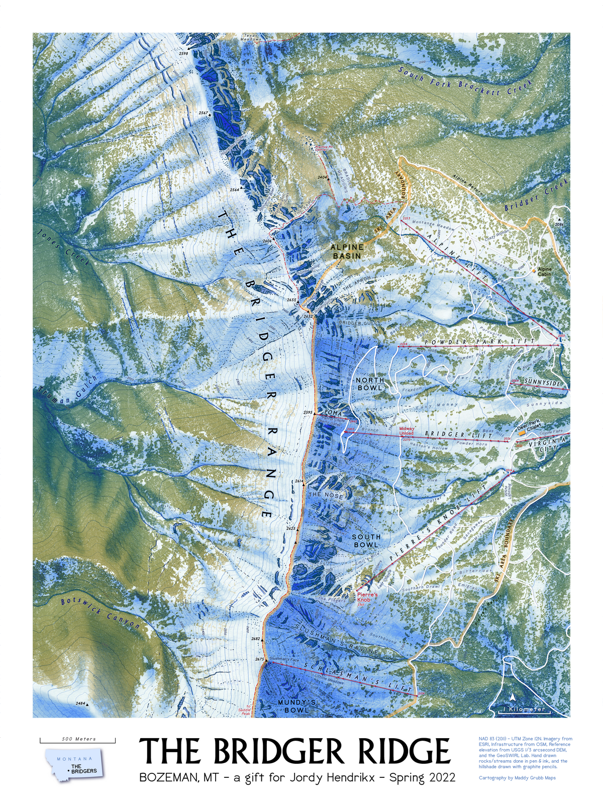
The possibilities are endless! I always am trying to push myself and explore new visual styles digitally. Everything from city zoning maps to skin tracks high in the alpine. If you have a map idea, bring it on.
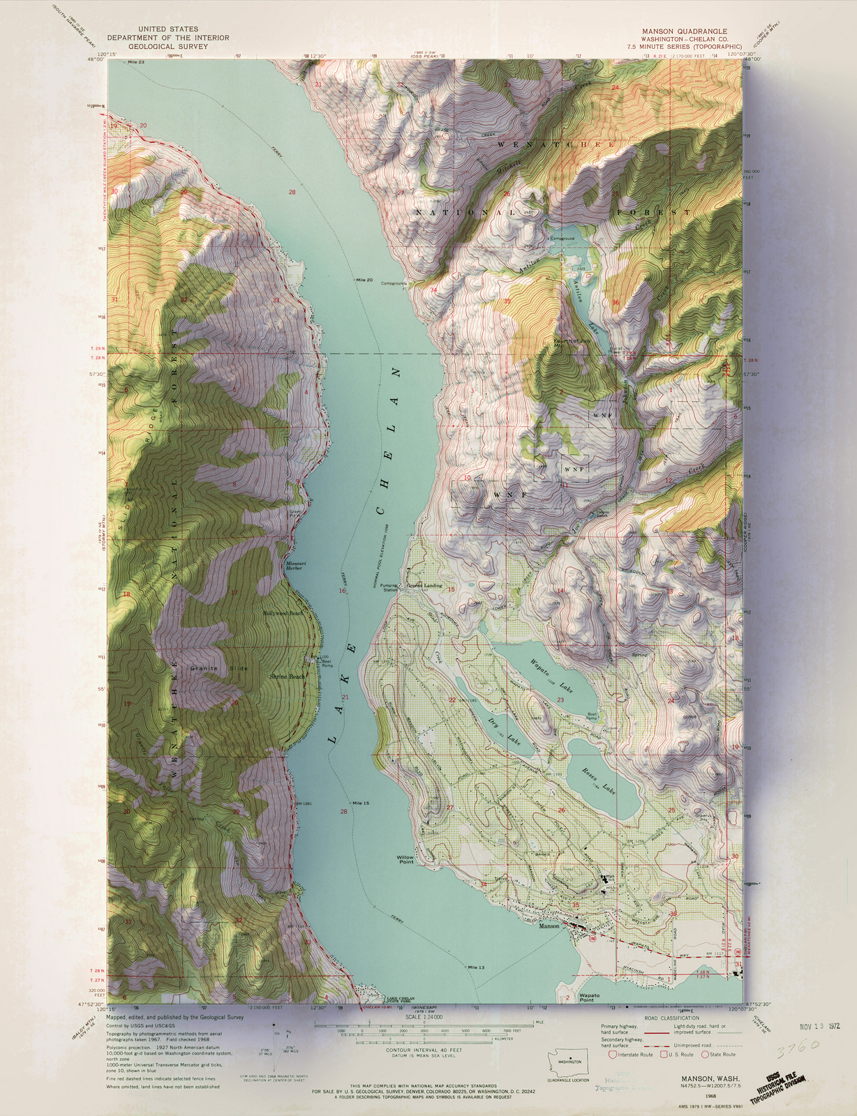
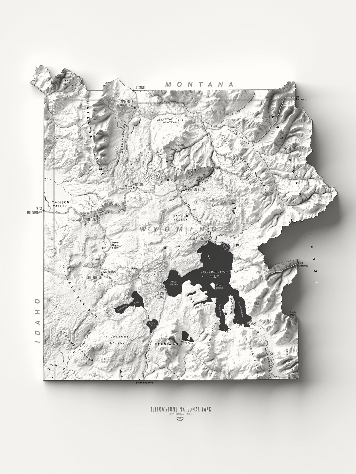
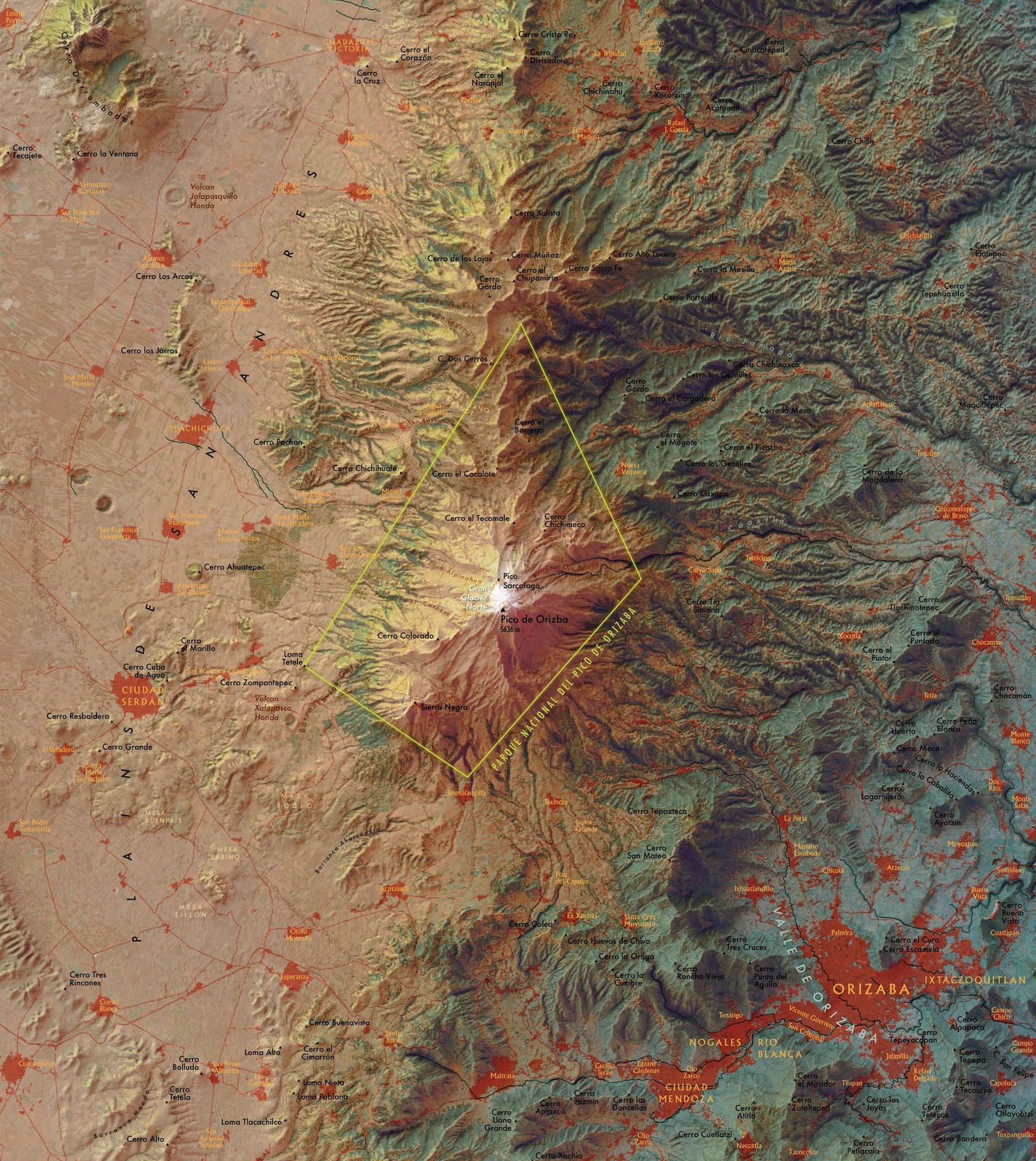
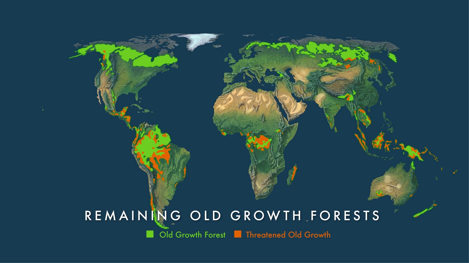
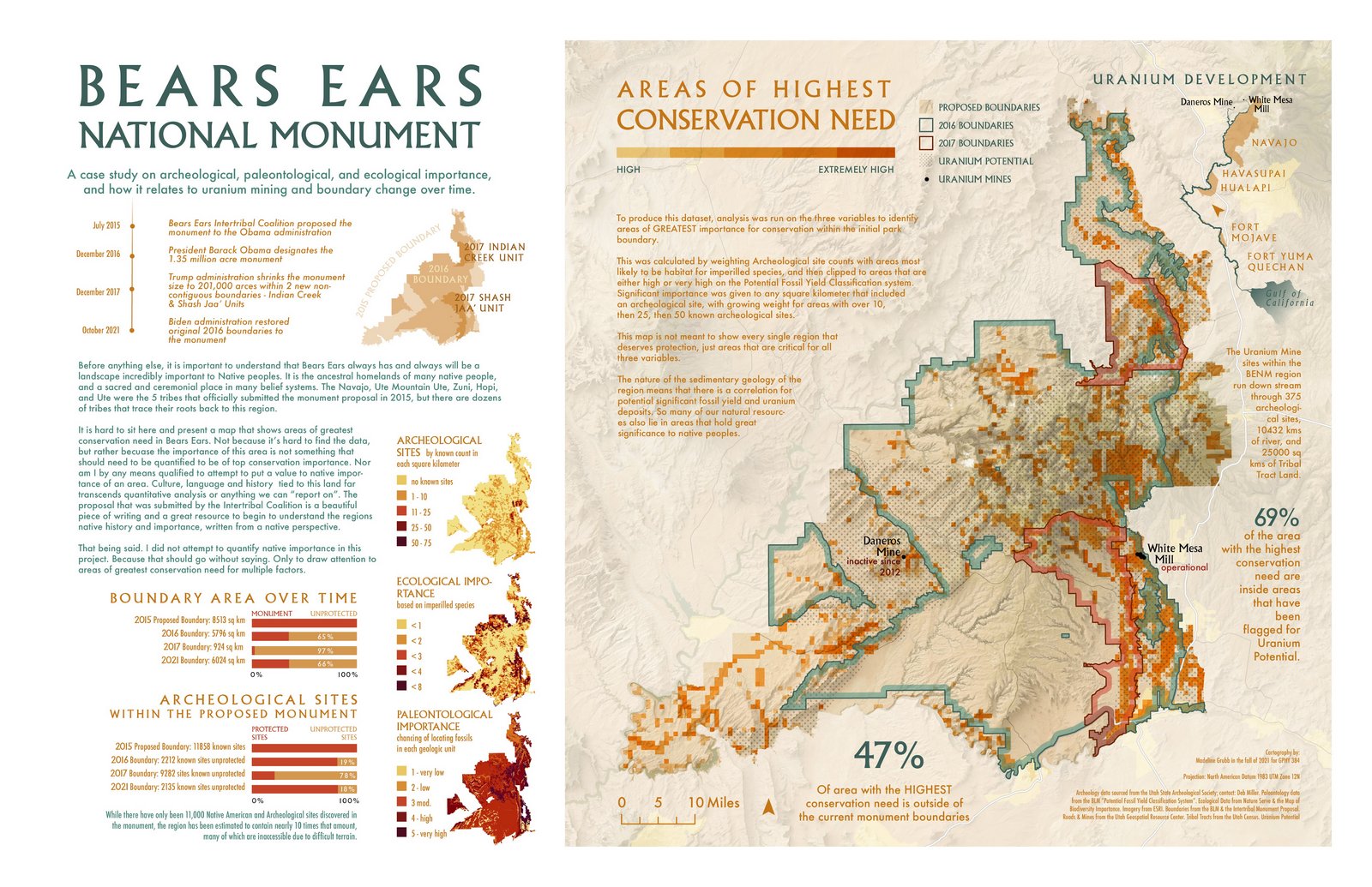
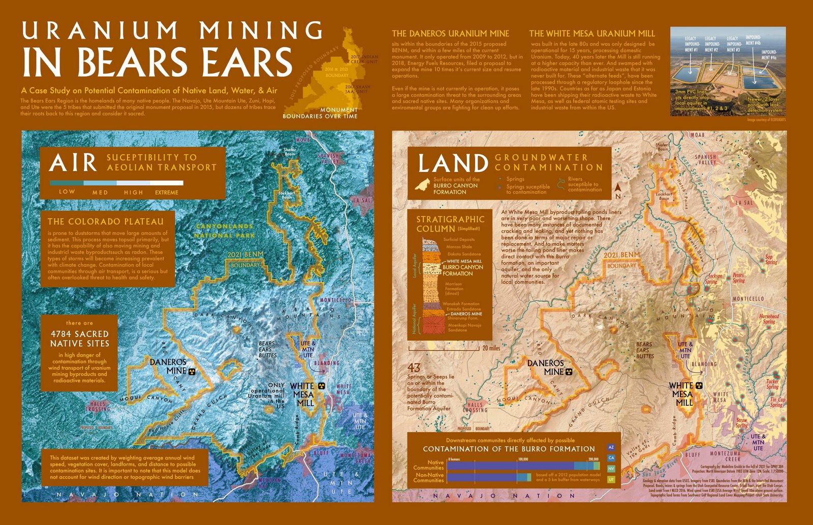
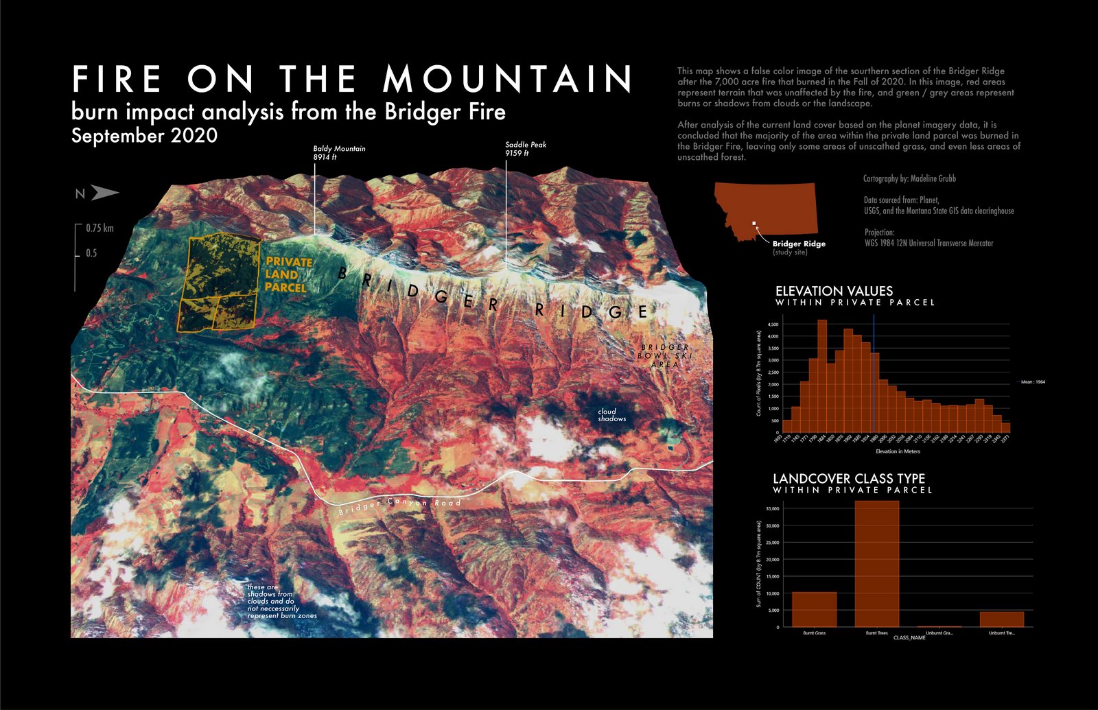
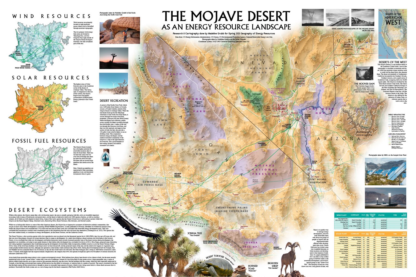
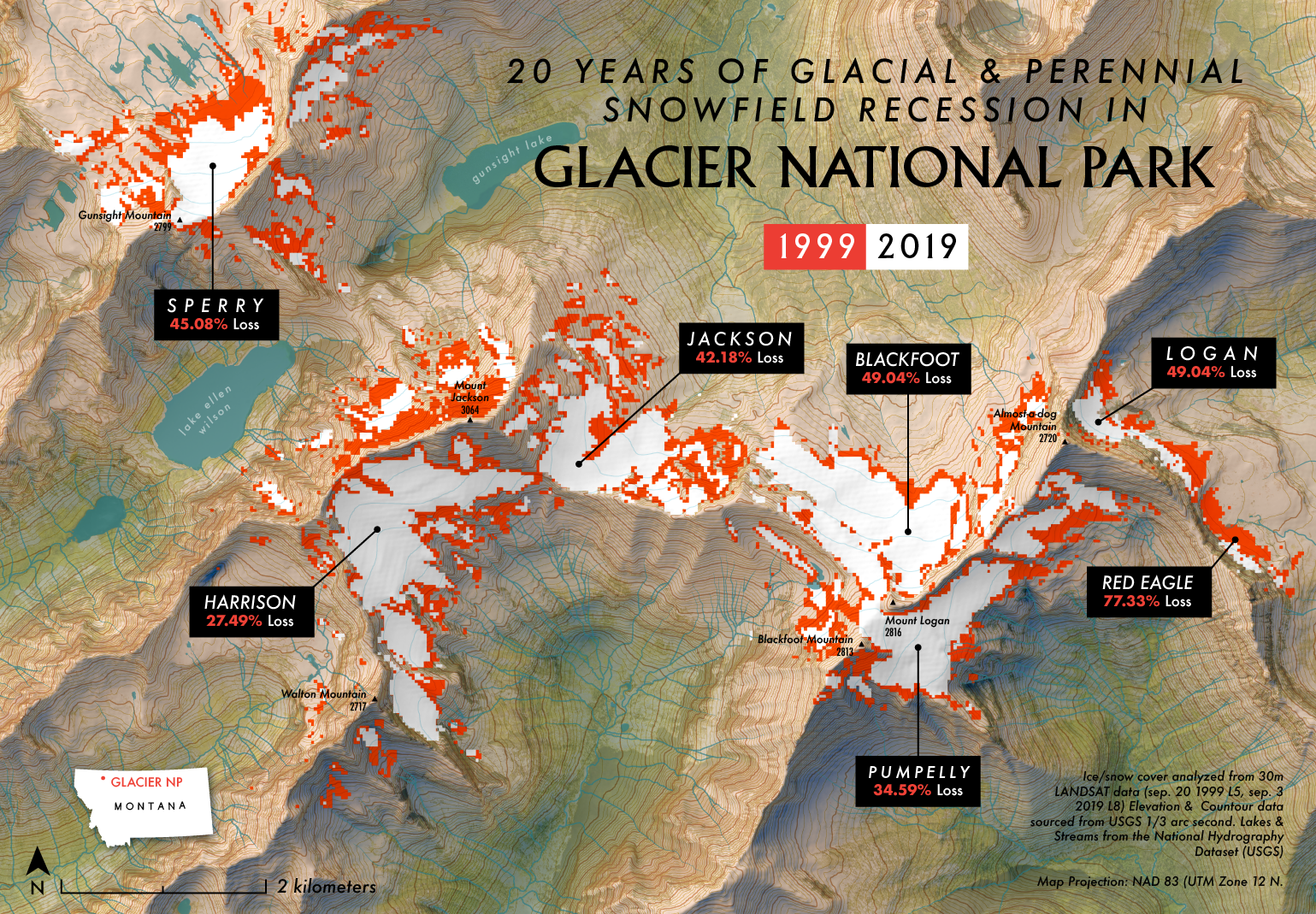
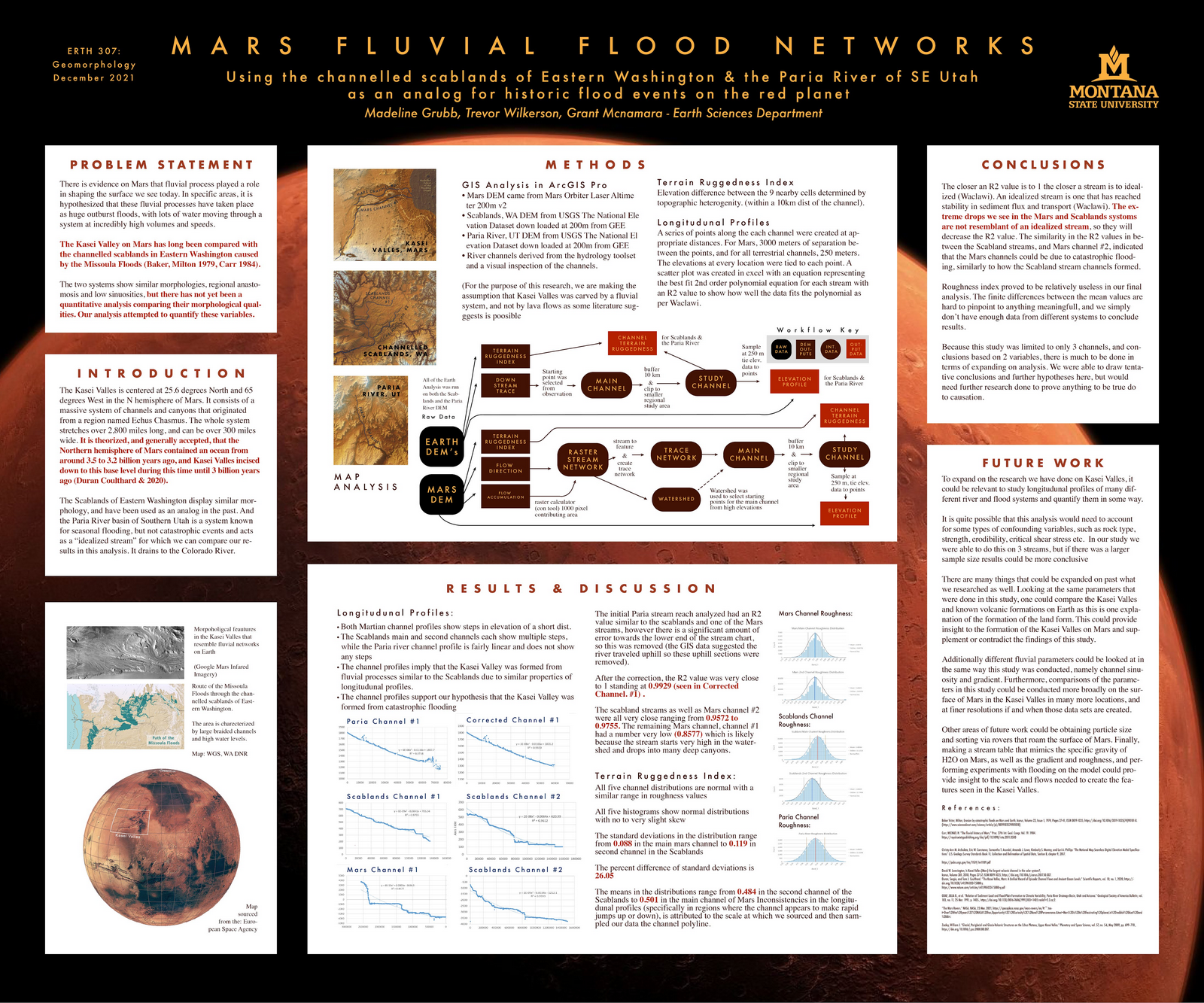
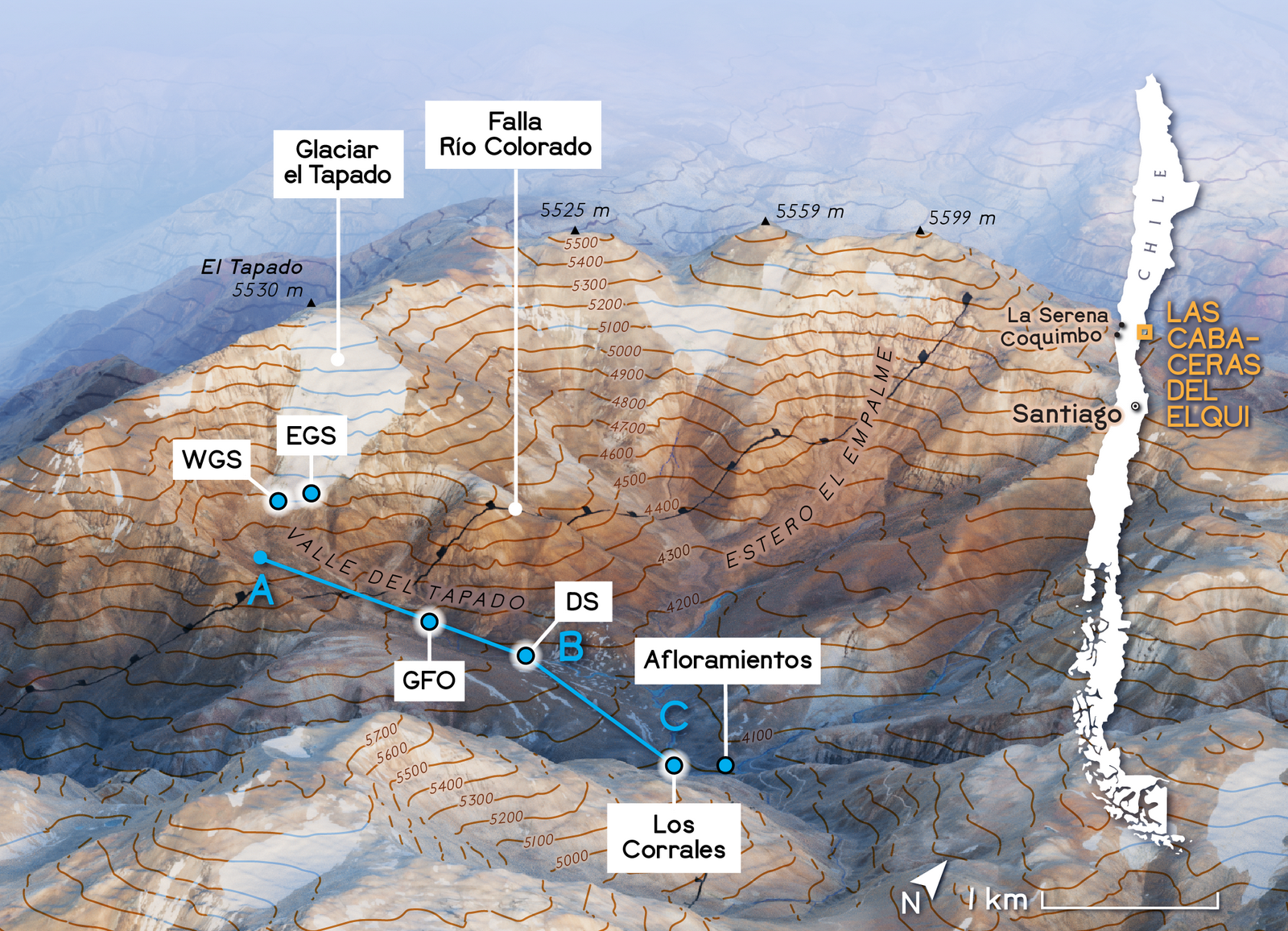
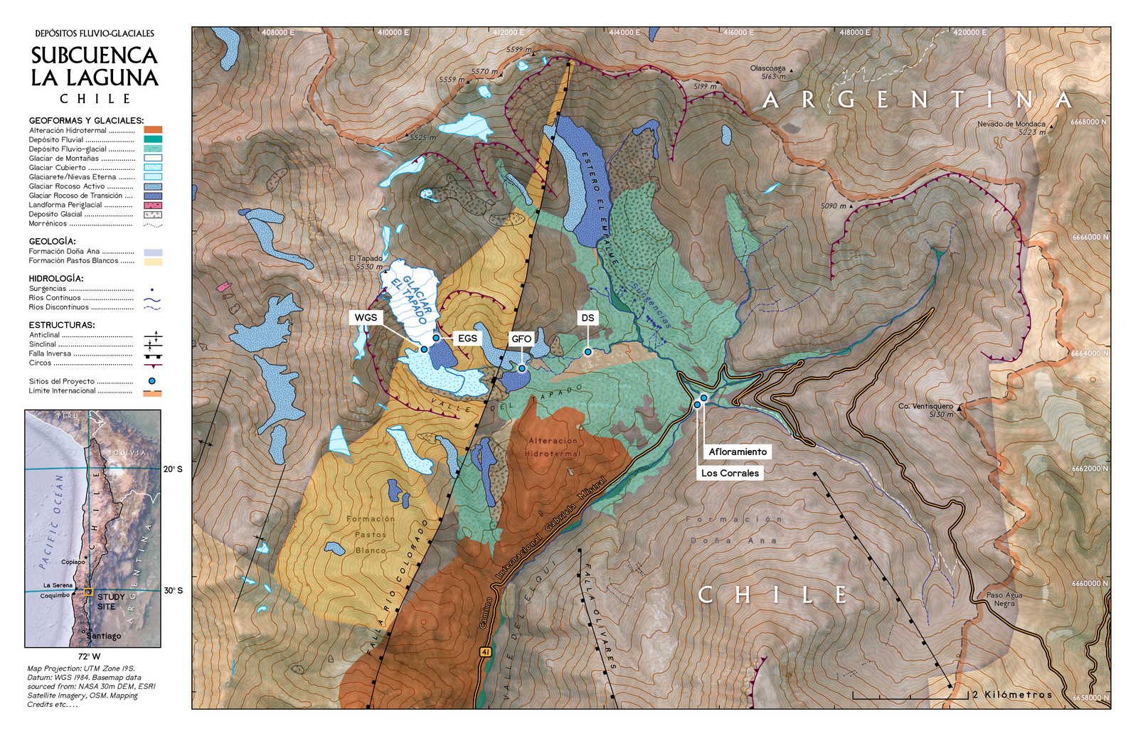
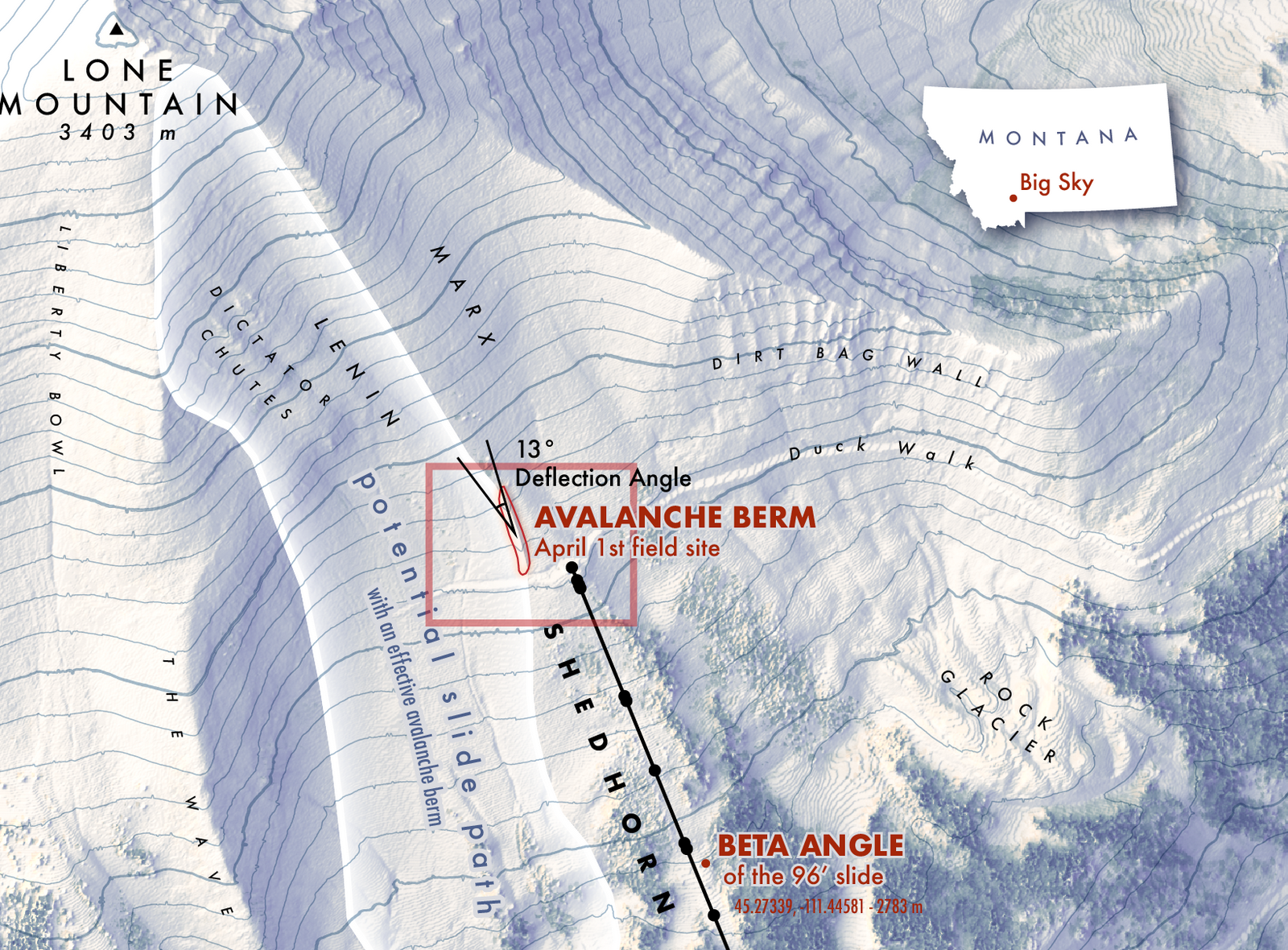
Social and Physical science research through GIS analysis and spatial statistics. I am particularly passionate in cartography for Earth Sciences (water/ice resources, geology, gemorphology, energy, ecology, fire) but am available for any type of place based anaylsis work! Experienced in industry standard (ArcGIS Pro, Adobe, etc.) as well as open source software (QGIS, Mapbox, Python, R)
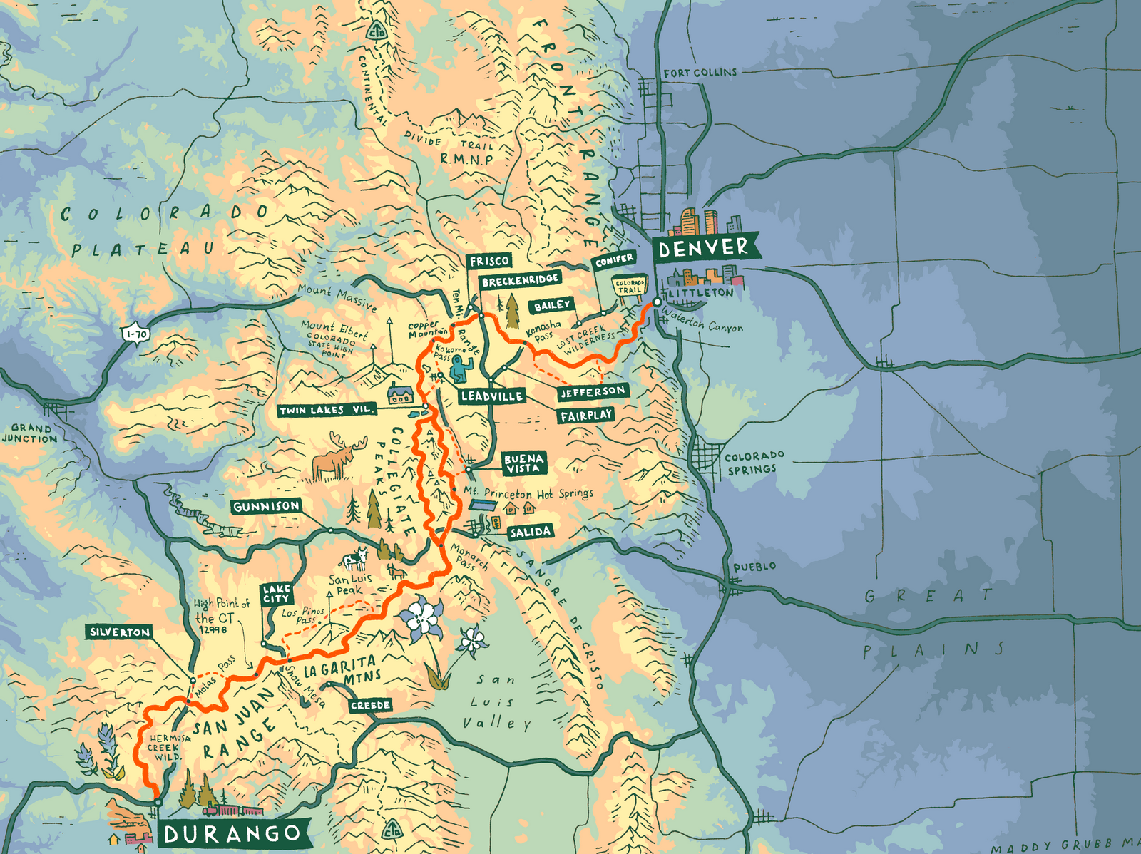
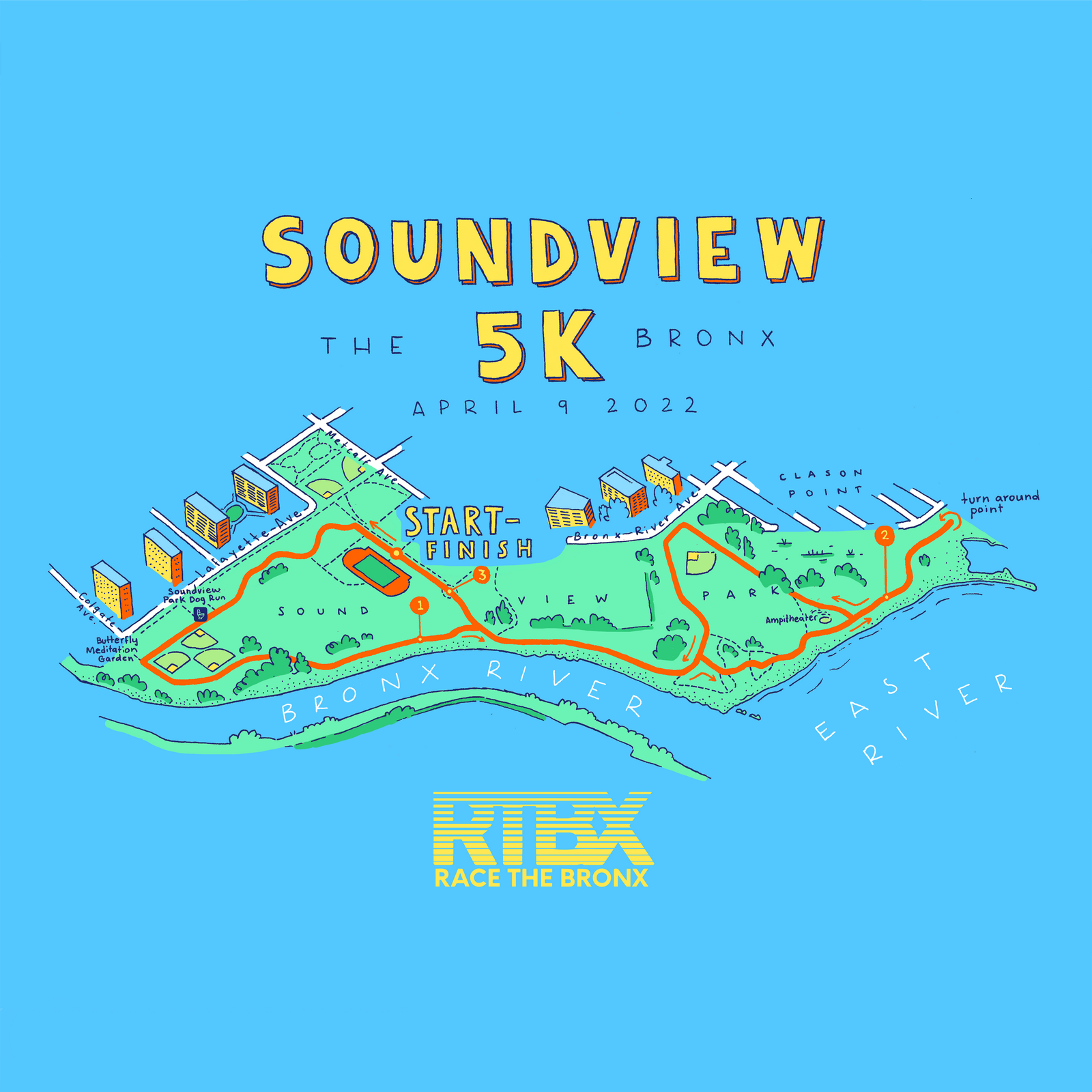
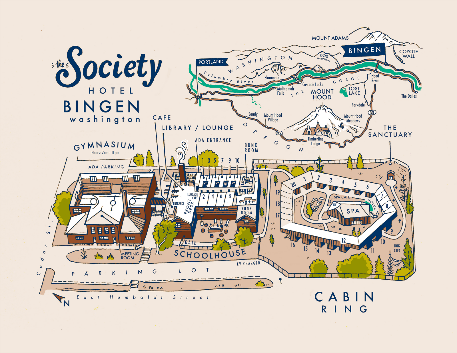
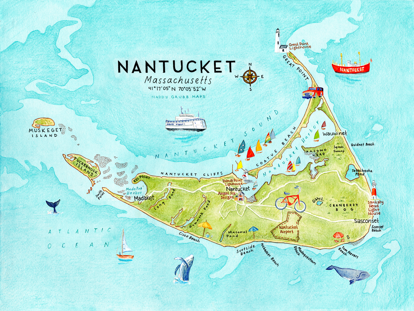
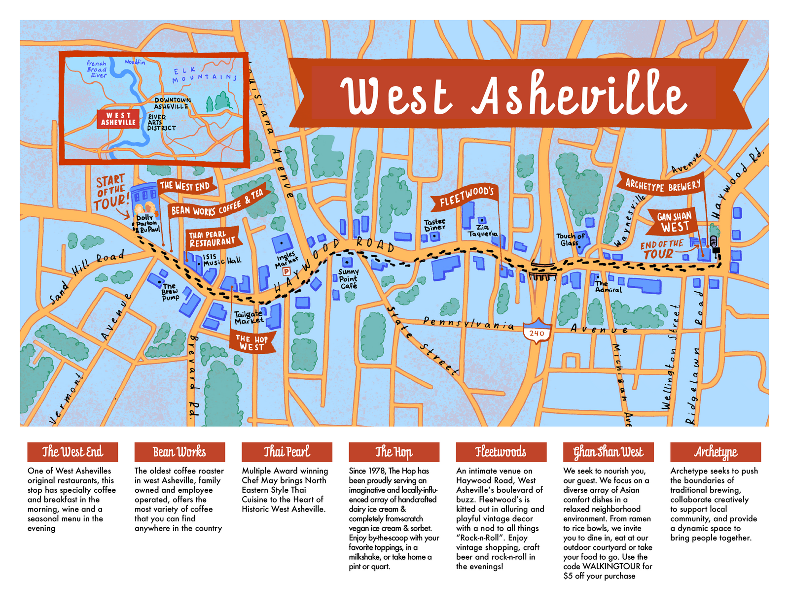
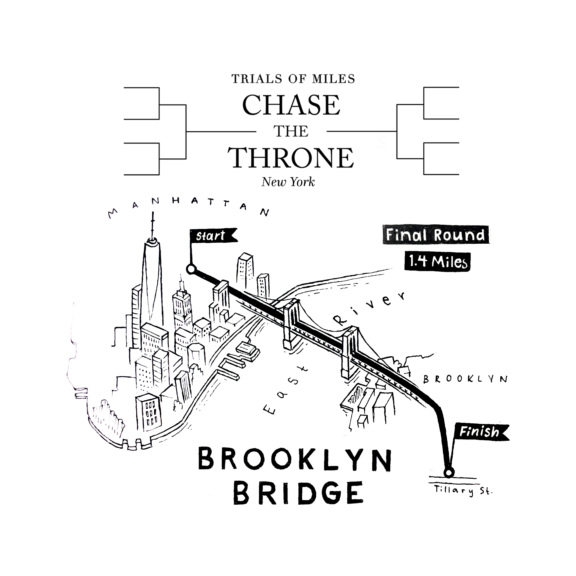
Blending the art of hand drawn illustration & digital coloring to create maps that really pop! Great for events, races, illustrative travel maps, tourism properties and long distance adventures!
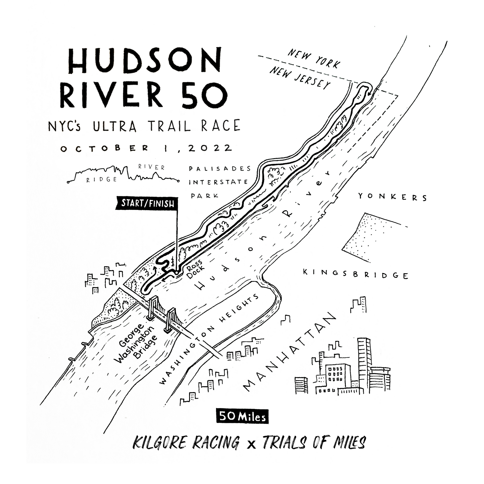
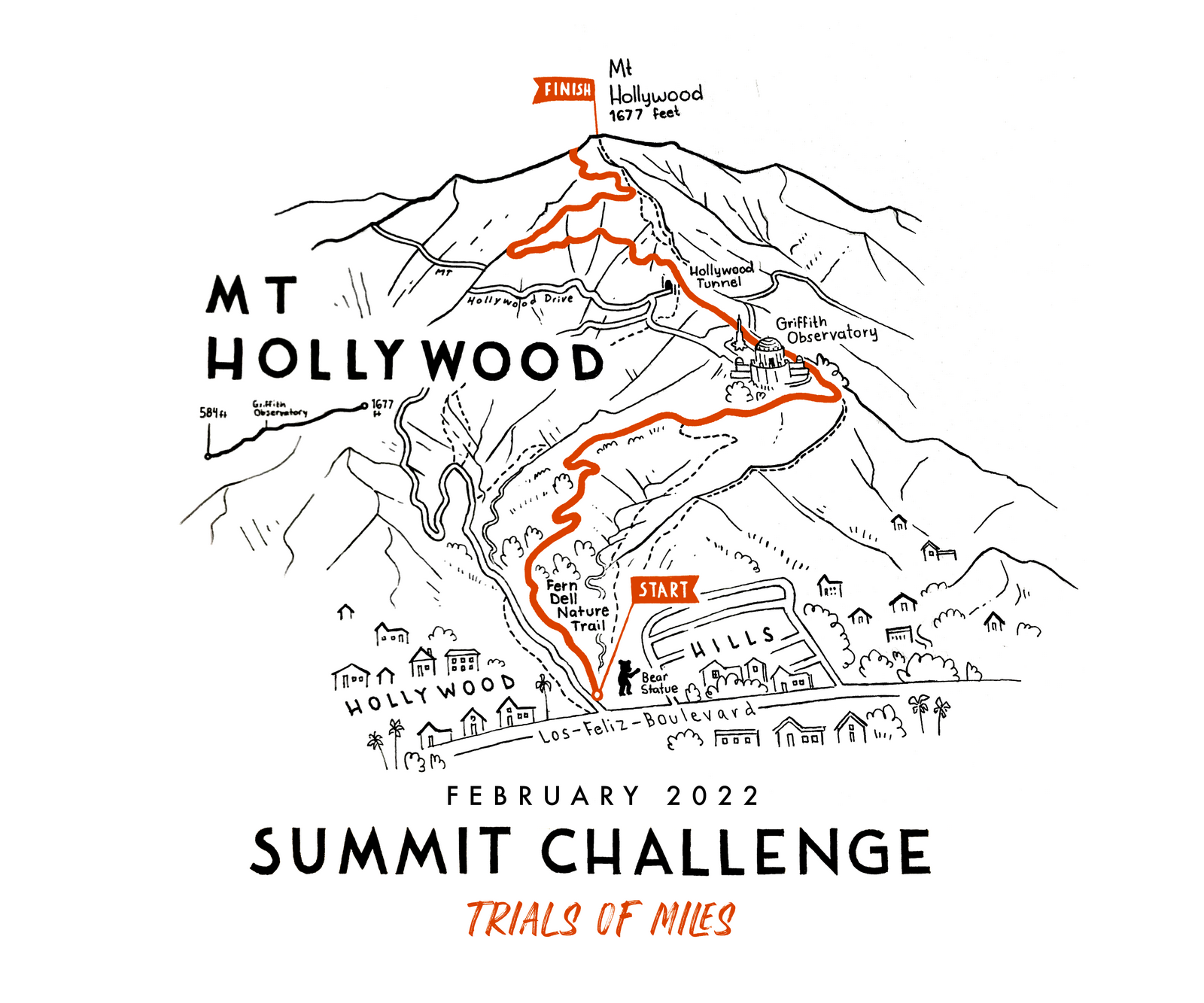
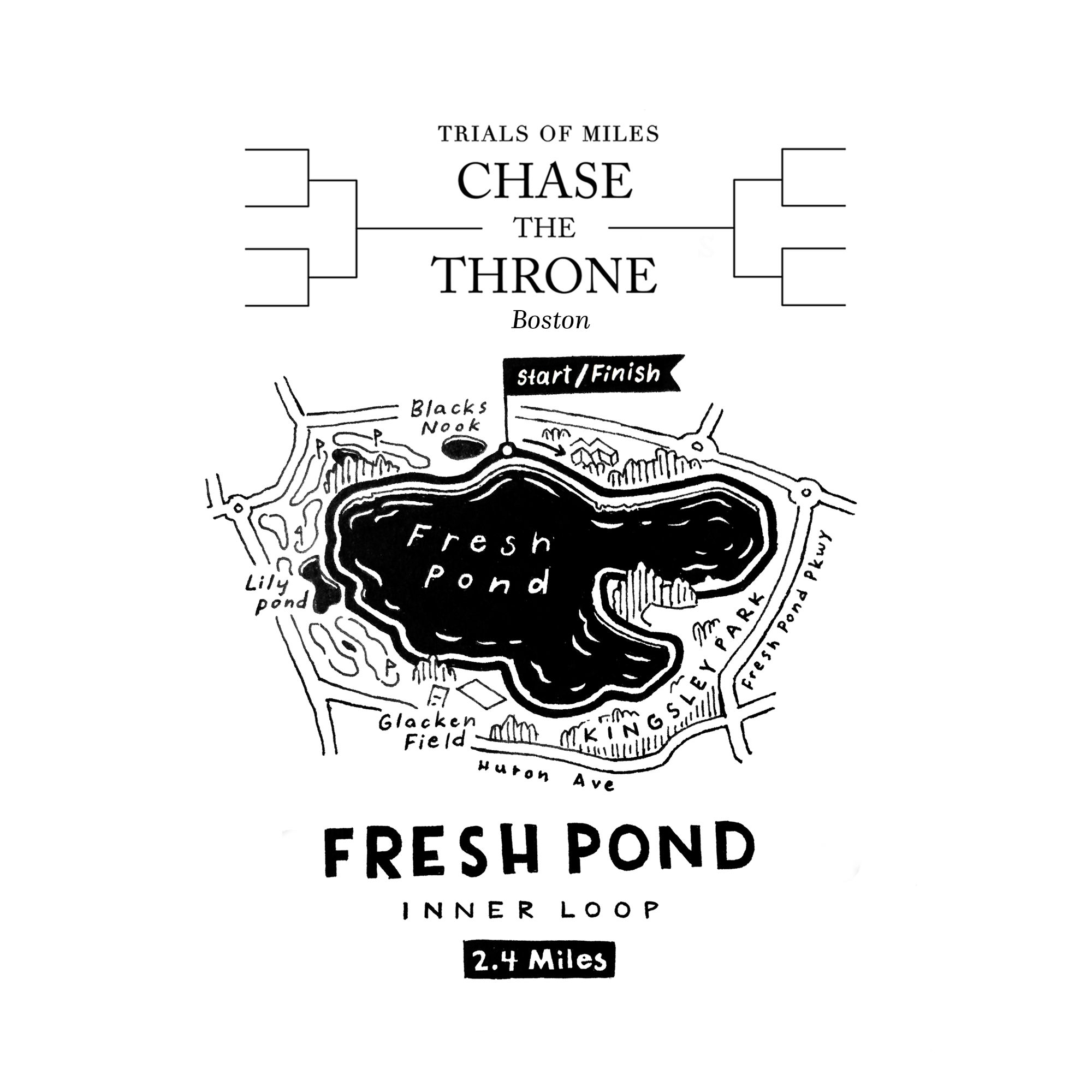
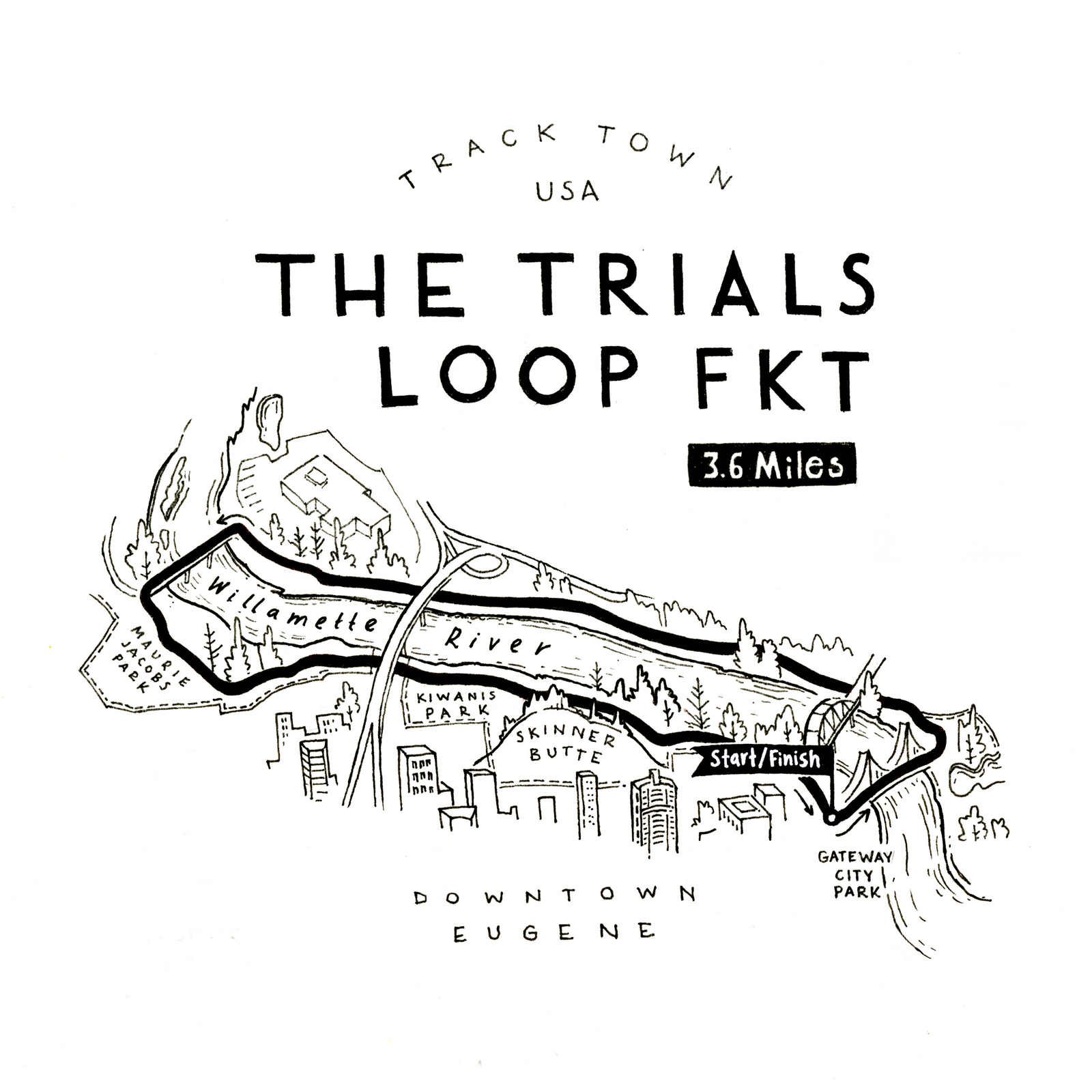
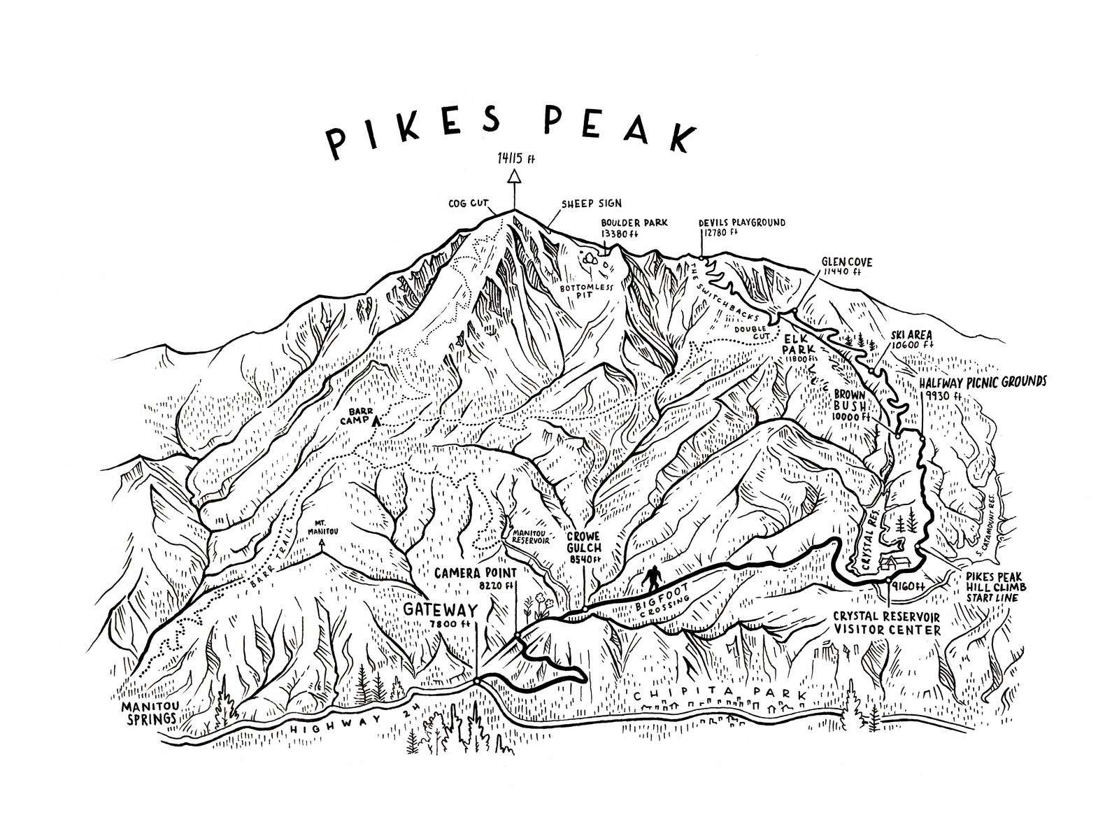
Sometimes all you need is sweet and simple. Black and white linework done by hand, gets the point across, and shows everything you need and nothing more.
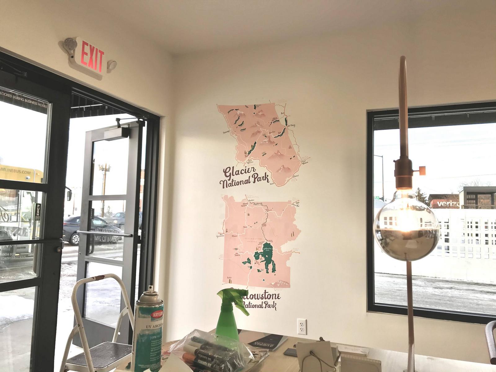
I paint large maps too! A fun bright map mural can brighten up any space.
created with
Website Builder Software .